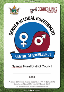
Nyanga Rural District Council.
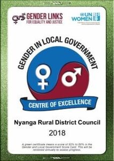
Nyanga Rural District Council.
Nyanga is located in Manicaland Province, in northeastern Zimbabwe, close to the international border with Mozambique.

Introduction
Nyanga is located in Manicaland Province, in northeastern Zimbabwe, close to the international border with Mozambique. This location lies immediately north of Nyanga National Park in the Eastern Highlands. Nyanga sits at an elevation of 1,679 metres, above sea level. Mount Nyangani, the highest mountain in Zimbabwe, lies about 20 kilometres, southeast of the town. Its highest peak rises to approximately 2,600 metres, above sea level Nyanga RDC covers an area of 5 897,82 km2, of which 28% falls under natural region 1 while 24% falls under Natural Region 2.
The rest of the district falls in natural regions 3, 4 and 5. The Rural District Council shares borders with Mutasa RDC in the south, Mudzi. Mount Nyangani, the highest mountain in Zimbabwe, lies about 20 kilometres, southeast of the town. The council is a spoke council in the hub and spoke programme for gender mainstreaming, mentored by Buhera RDC. According to the 2022 population census Nyanga RDC had 39,368 households with an average household size of 3.7.

Key Achievements
Three council employees (women) undertook professional studies to prepare for leadership roles.
Council support Comprehensive Sexual Education (CSE) in schools.
Piloted and implemented a community based sustainable solid waste management.
Awards